Landloch provides solutions to environmental problems to a wide range of industry sectors and environmental settings. Our aim is to provide scientifically sound solutions that can be practically implemented.
Our team of soil and environmental scientists, engineers and technical staff are uniquely skilled in assessing soil, water, land, and vegetation issues across landscapes in Australia and internationally. We have decades of experience in providing solutions to our clients in mining, construction, coal seam gas, agriculture, forestry and rangelands, water pipelines and roads.
Landloch apply leading-practice land management, rehabilitation, and landform design techniques. These include soil and land capability mapping, soil and mine waste characterisation, erosion testing, erosion modelling, landform design, landform evolution modelling, and geomorphic landform design. We are also skilled in water-solute balance modelling to assist in managing interactions between climate, soils, and vegetation. This guides our recommendations on the most suitable land management solutions on a “site by site” basis.
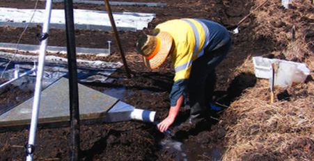
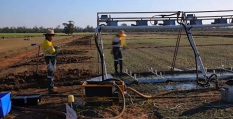
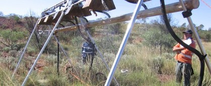
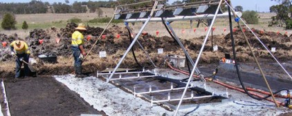
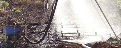
Our techniques are supported by a range of specialised equipment, including erosion testing laboratories in Australia and southern Africa, and mobile testing equipment that can be deployed to any location in Australia, Africa, North America, and South America.
Why Choose Us ...
Grounded in ScienceLandloch takes a different approach to the preparation of reports and modelling. The Landloch team understand that reports and designs must not only be grounded in sound, time-tested scientific principles, but they must also be fundamentally useful to the end user. The team works closely with you to ensure your stakeholders understand what recommendations are being made, why they are being made, and how to implement them.
|
Erosionally Stable Landform Designs
When it comes to land and soil rehabilitation, mine rehabilitation and closure, the problem with many scientific reports, designs and modelling is that there is too frequently a disconnect between the design and execution in the real world. When projects fail, the costs to companies sky-rocket in dollar terms, and are incalculable in environmental terms.
|
Unique follow-throughLandloch consultants work with people at every level of an organisation, from the people in the field to board members and management in a creative and flexible way to assist that organisation to achieve the results they need. We regularly achieve dramatic project cost savings for our clients for one distinct reason ... we don't just give you a plan. We help make sure the plan is implemented.
|
Our Services Include ...
Some of Our Work ...
|
Progressive rehabilitation and closure plan, PRC plan, transition progressive rehabilitation plan, Erosion assessment, Waste rock management plan, rehabilitation monitoring, LFA, landscape function analysis, receiving environment monitoring program, spoil disposal plan, environmental management plan, easement management, right of way management, waste dump design, rock armour, natural landform design, soil survey, erosion and sediment control, review of environmental factors, environmental effects statement, mining environmental approvals, site environmental management plan, protected flora survey, Surat Basin, bowen basin, coal seam gas, abandoned mines, environmental authority, quarry, mining bond, mine closure, closure signoff, mine rehabilitation signoff, progressive rehabilitation, dispersive soil management plant, ecodoser, turbidity, mined land rehabilitation, financial assurance mine, residual risk payment, landform evolution, Siberia modelling, erosion remediation, gully remediation, pipeline erosion, erosion control, sediment and erosion control, sediment and erosion control product testing, expert witness, dispute resolution, defect liability period assessment, environmental auditing, effluent disposal, effluent irrigation, water balance modelling, waste dump design, rehabilitation and closure plan, soil and land suitability assessments, soil mapping, soil survey, acid sulfate soil, ASS, stream rehabilitation, environmental incident and emergency response, biophysical strategic agricultural land, BSAL, Strategic cropping, land, soil management land, land capability, land rehabilitation, weed management, ACDC, WEPP modelling, Caesar modelling, batter stabilisation, drain erosion, gully, tunnelling, gypsum rate, revegetation, Hunter valley, Newcastle, Toowoomba, Darling Downs, Perth, Pilbara, lithium mine, iron ore mine, coal mine, sand mine, soil testing, soil monitoring, environmental authority land, Certified professional soil scientist, Certified professionals in erosion and sediment control, training, soils training, rainfall simulation, erosion control product testing, erosion laboratory, compliance audits, environmental management system audits, science, concave slope, golden gecko, performance indicators for rehabilitation, DES negotiations, stabilization, sign-off, rock armor, tunneling, re-vegetation, re vegetation, vegetation, dispersion, disperse, rehab, soil survey, consultant, consulting, soil scientist, soil management, mapping, GIS, sodic, sodicity, pipeline, gas pipeline, water, surface water, drainage, effluent disposal, land and soil capability assessment, erosion modelling, soil Toowoomba, soil Perth, soil Newcastle, CPESC Toowoomba, CPSS Toowoomba, CPESC Newcastle, CPSS Newcastle, CPESC Perth, CPSS Perth, BSAL consultant, BSAL Newcastle, BSAL NSW, environmental consultant Newcastle, environmental consultant Perth, environmental consultant Toowoomba, erosion control Newcastle, erosion control NSW, erosion control Perth, erosion control WA, erosion control QLD, New South Wales, Queensland, Western Australia, land and soil capability assessment consultant, BSAL consultant, LFA consultant, soil consultant, land and soil consultant, soil survey Queensland, soil survey New South Wales, soil survey Western Australia, soil survey QLD, soil survey NSW, soil survey WA, soil assessment Queensland, soil assessment New South Wales, soil assessment Western Australia, soil assessment WA, soil assessment NSW, soil assessment QLD, soil consultant NSW, soil consultant QLD, soil consultant WA, BSAL mapping, land capability mapping, BSAL map, land capability map, landform evolution modelling, geomorphic landform design, Geofluve, landscape function analysis consultant, landform and geomorphic design, Geofluve, geomorphic landform design, Geofluve, landscape function analysis consultant, landform and geomorphic design, Geofluve

